


While some modern solutions make use of online platforms to direct people, the context of use for the majority of these resources is at home on your desktop. This system aims to simplify available information at high traffic junctions, communicate data effectively to visitors, and promote an active lifestyle through its success.
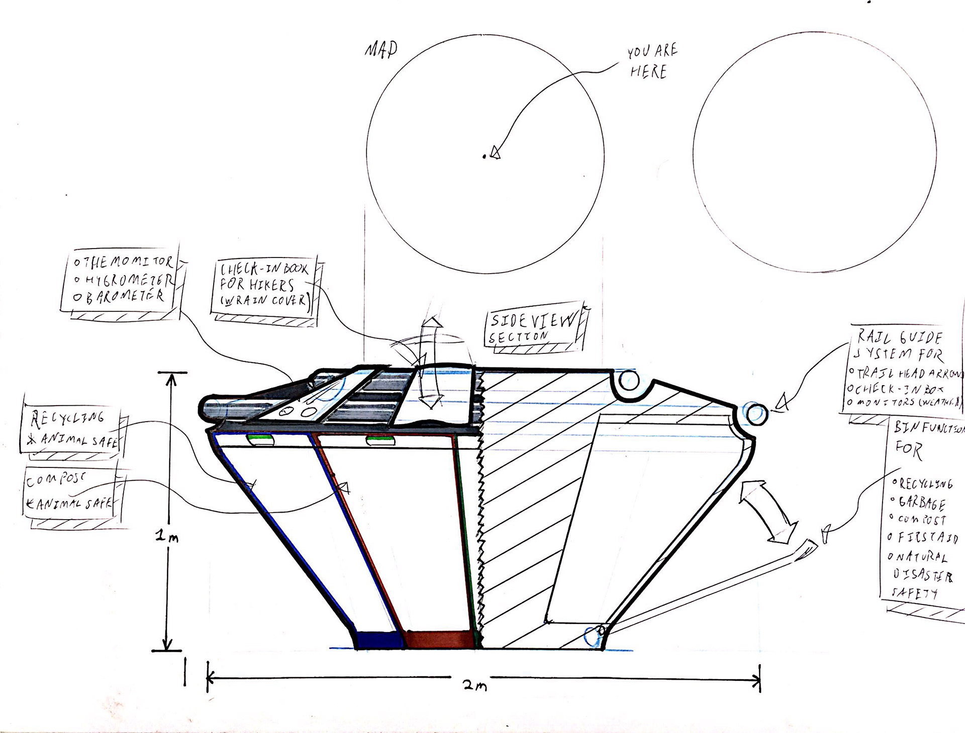

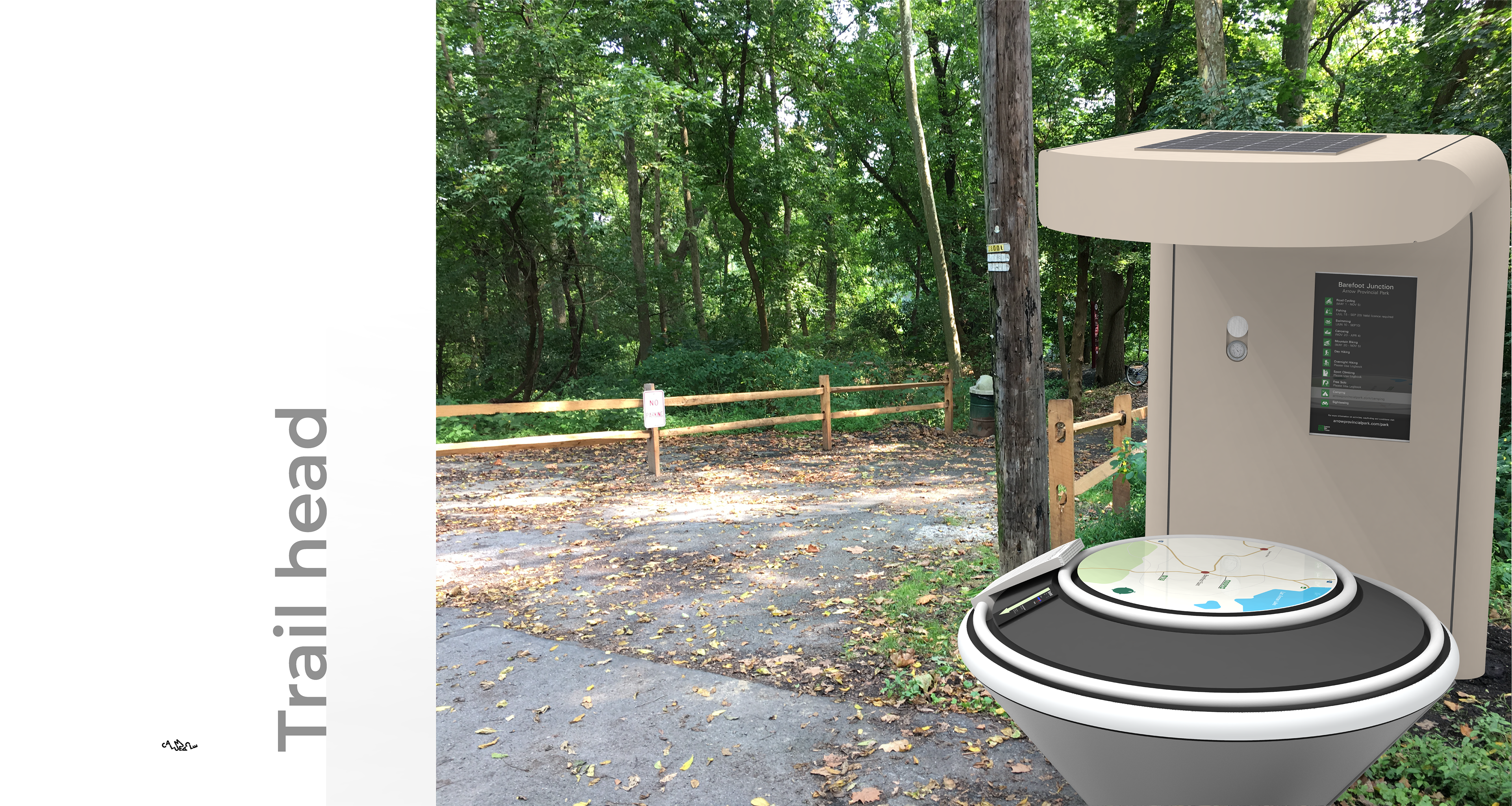
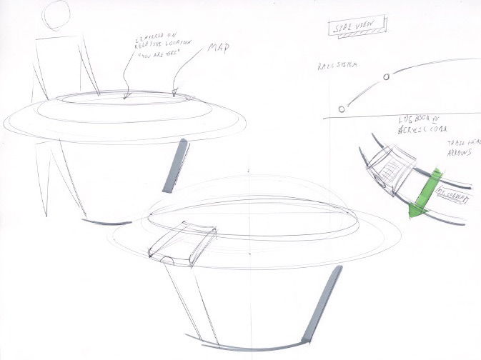
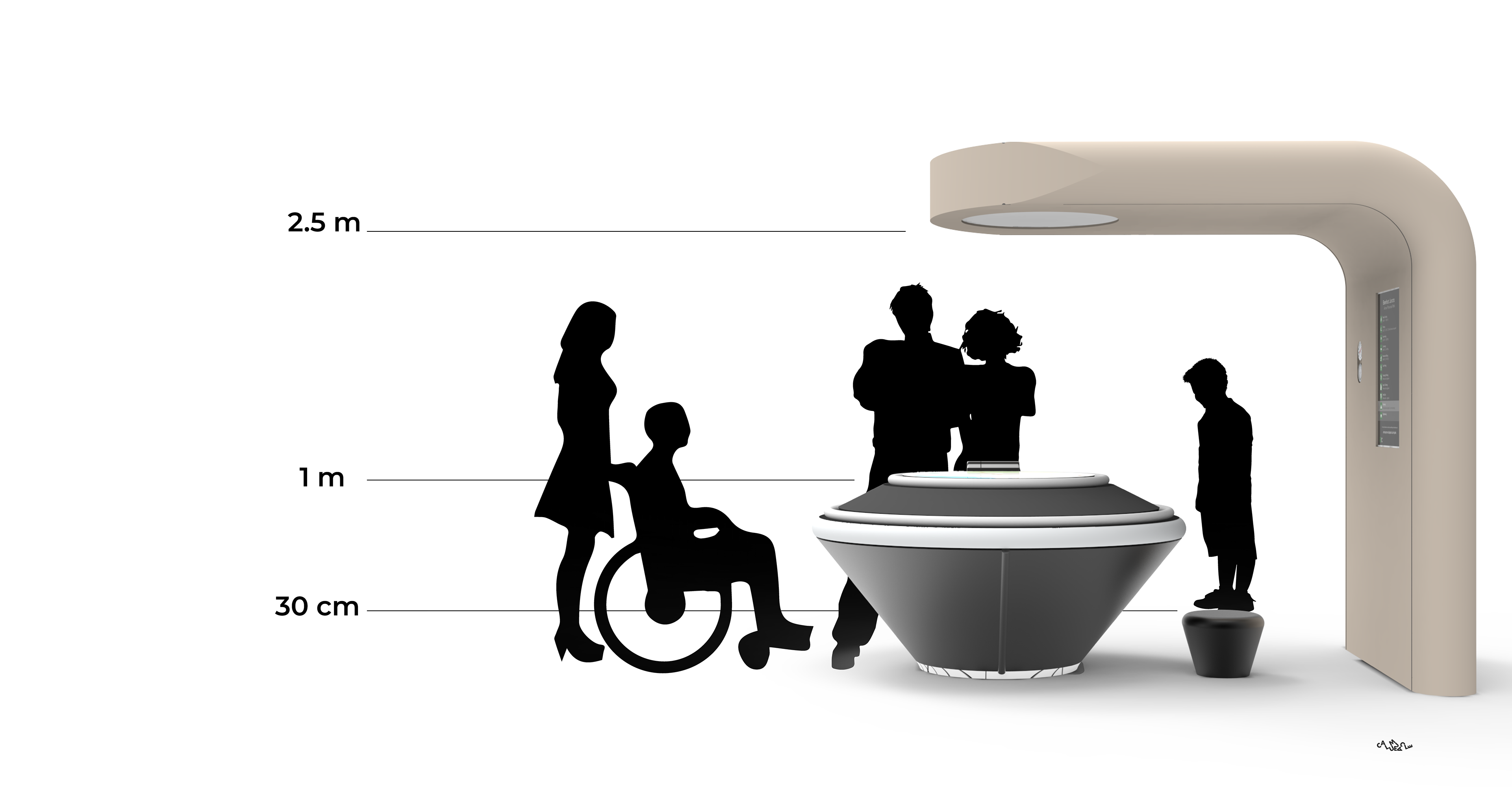
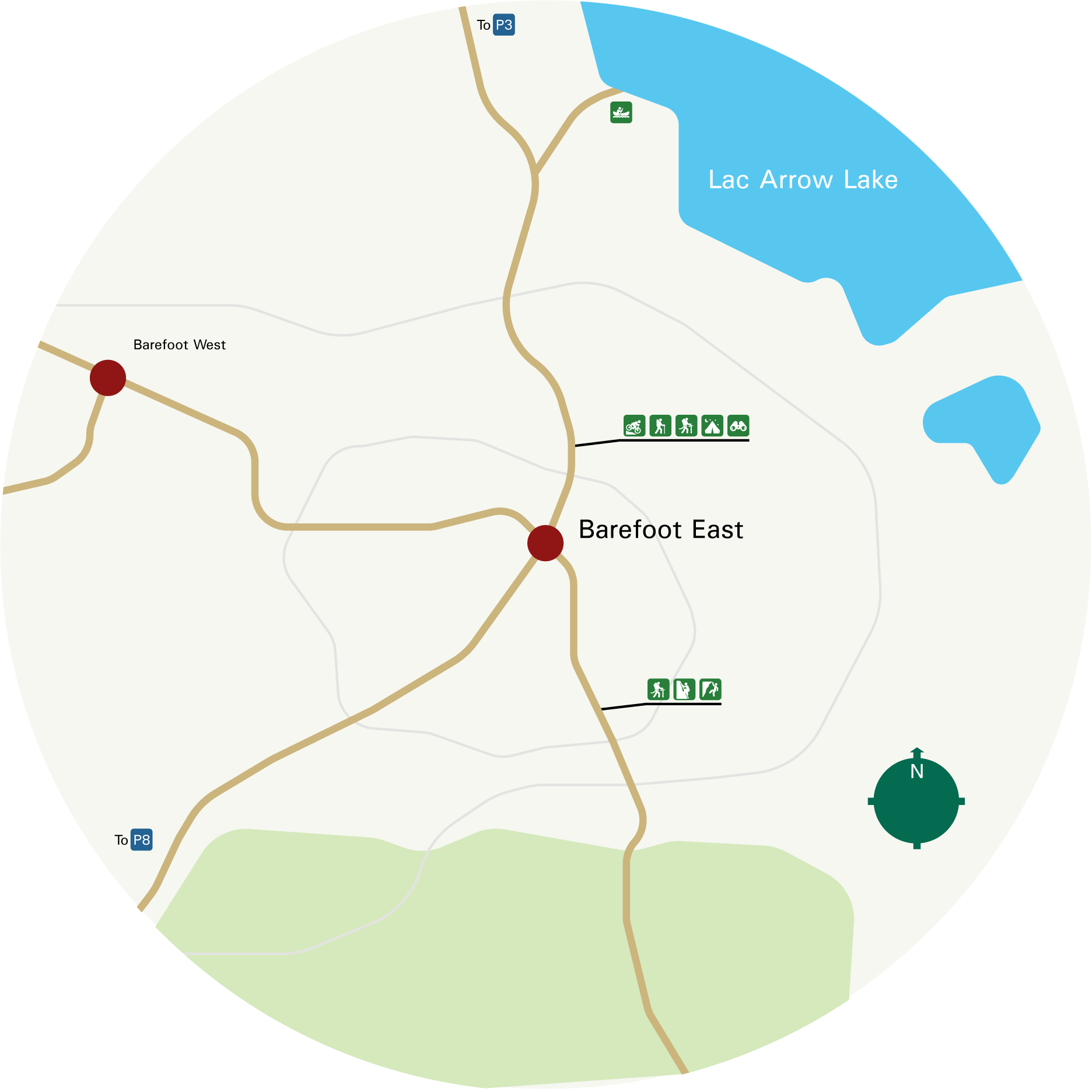
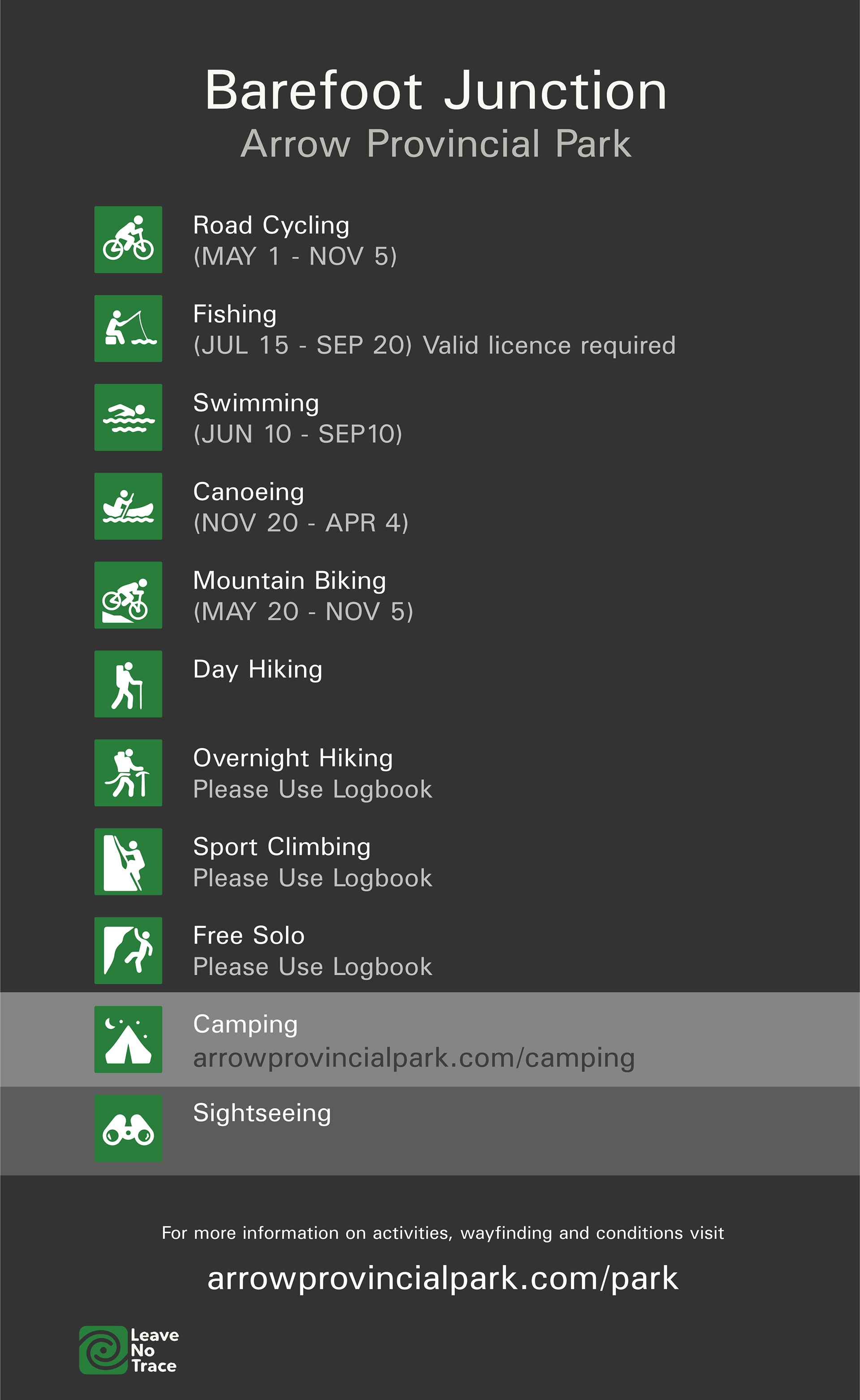
With my problem area focused to the wayfinding systems in public spaces like national and provincial parks, I had to research the kinds of users and stakeholders that were involved. Athletes that are seeking to surpass physical limits are using the same space as the casual strollers, and parents with strollers for that matter. In order to communicate important wayfinding information quickly, I designed a map to be stood over, making it more naturally oriented for the modern users of GPSs, where map positioning is flat and relative only to your position. The trailhead arrows then compliment the table map layout by providing further instructions and information related to the trail. The inclusion of logbooks directly beside, reduces the risk of having unlogged hikers on dangerous trails.

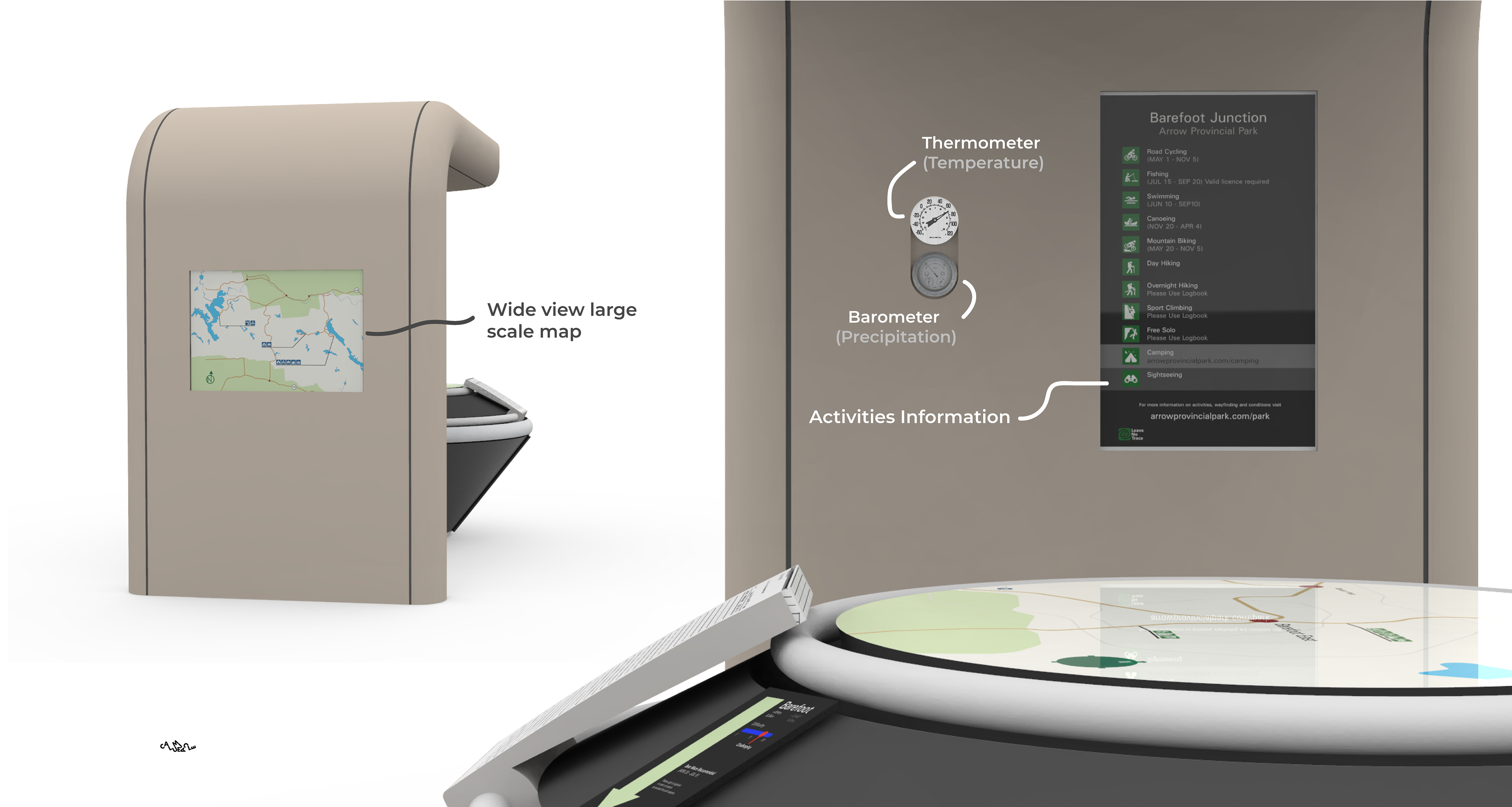
Above are the panels that I designed in Adobe Illustrator to add onto the SolidWorks file of the final 3D Model.
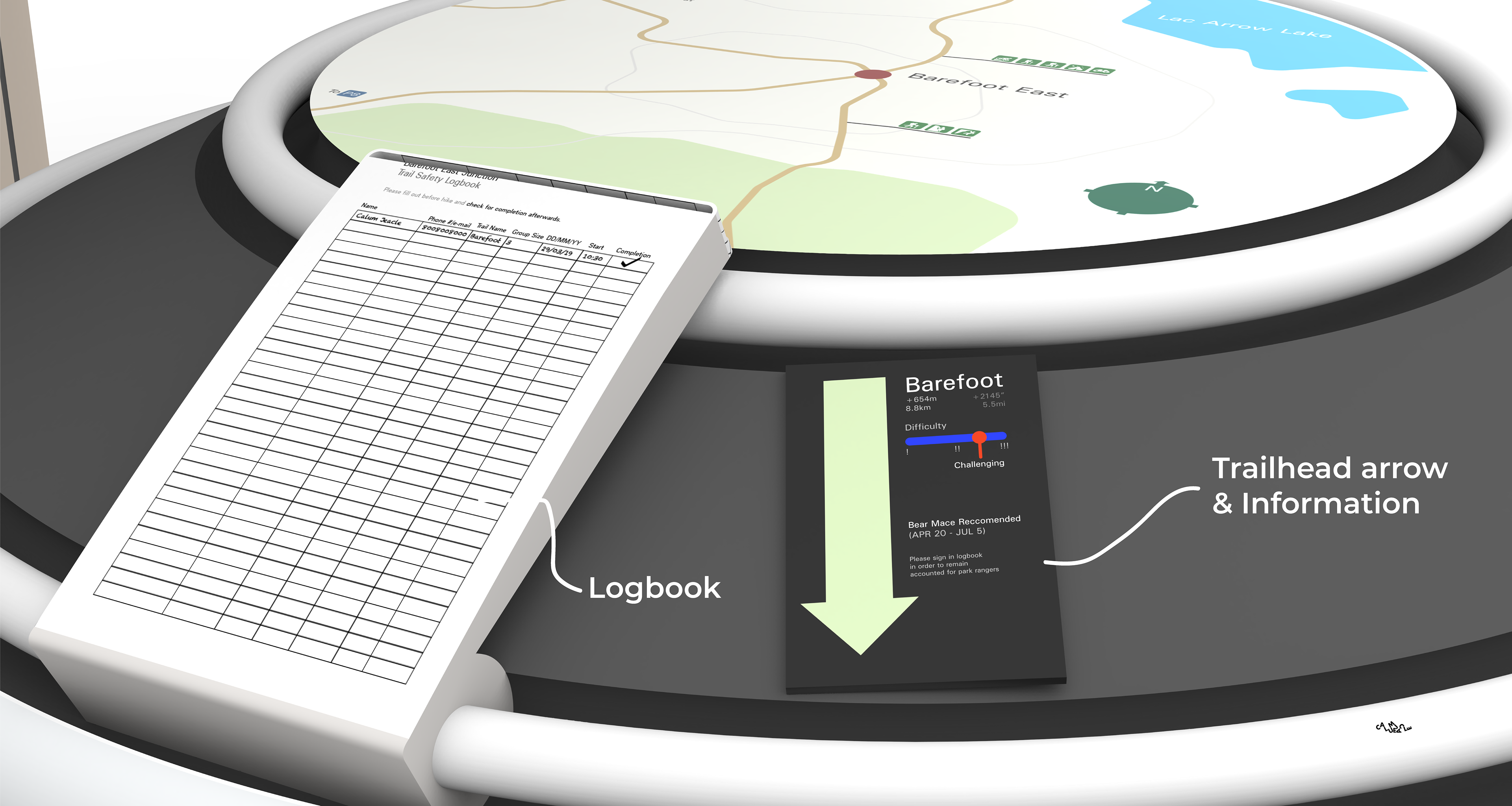
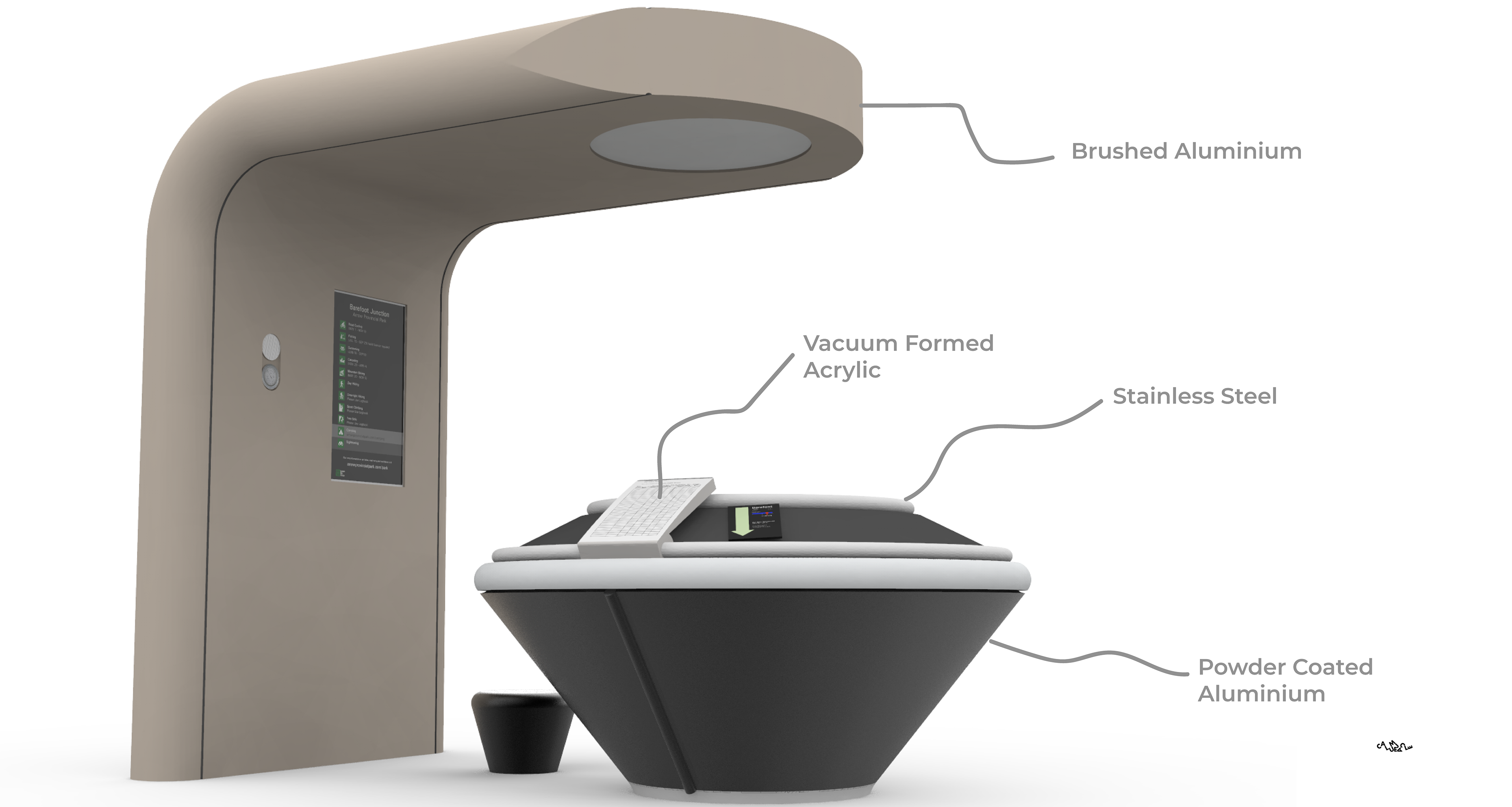
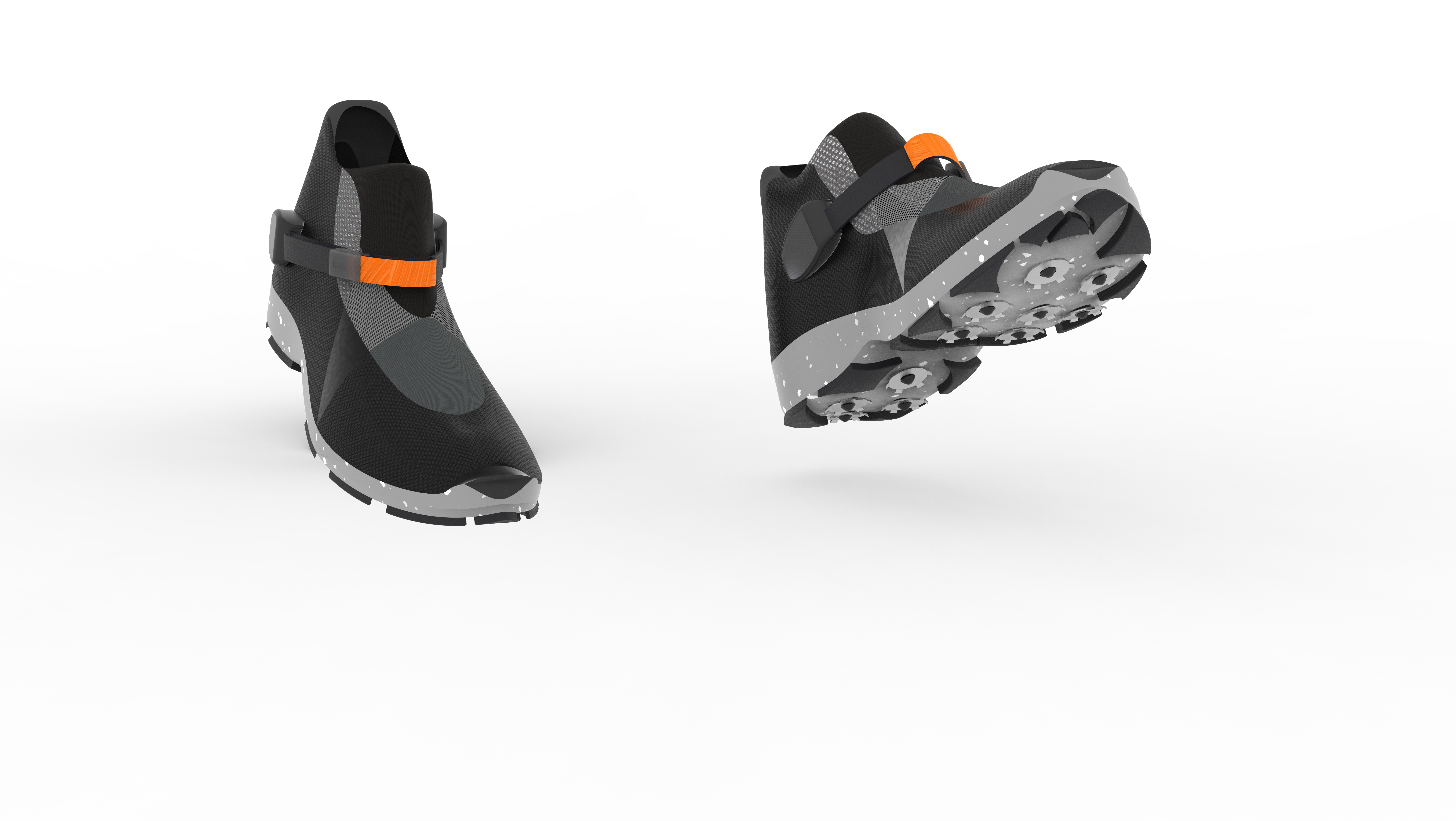
The build itself would be composed of powder-coated aluminum for exterior housing, stainless steel tubing for the hand rail / logbook & trail information rail and mild steel pipes for the interior chassis. Surfaces would have matte finish to reduce glare in the outdoor environment of use, except the acrylic cover of the logbook which would have a shiny finish to direct attention to it. All illustrated text is in “Univers” font for superior legibility.